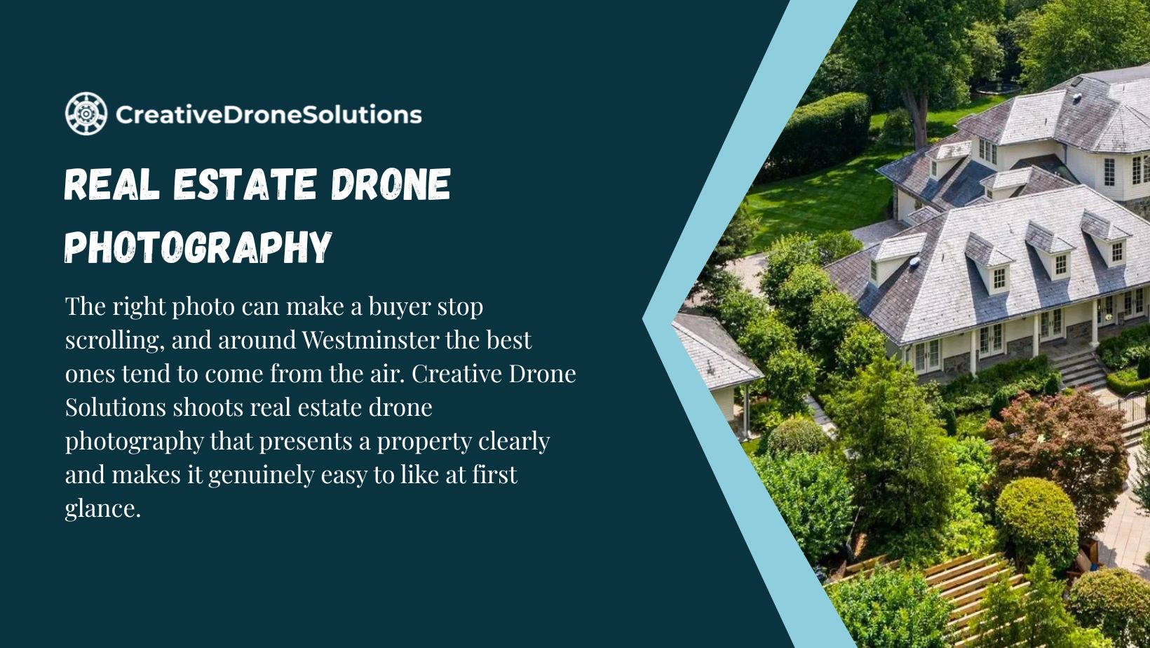
If you have scrolled through listings in Westminster lately, you already know how fast buyers judge a property. A handful of seconds decide whether they click into the gallery or move on to the next house in the feed. That is exactly where real estate drone photography services in Westminster, CO earns its keep. A well-shot aerial image does something a ground-level photo cannot: it shows the whole property at once, the lot size, the roofline, the neighborhood context, and the open space around it, all in a single frame that stops the scroll.
At Creative Drone Solutions, we shoot real estate drone photography for agents, homeowners, developers, and property managers across Westminster and the surrounding Front Range communities. This guide walks through what property drone photography actually involves, why it matters more in a market like Westminster right now, and what to expect if you are ready to book a shoot. Along the way we will answer the questions we hear most often from agents who are trying this for the first time.
What Real Estate Drone Photography Actually Involves
Real estate drone photography is not just a novelty add-on to a standard listing shoot. It is a specific skill set that blends piloting, camera work, and an understanding of what actually helps a home sell. A drone photographer flies a small aircraft equipped with a stabilized camera over and around a property, capturing images from angles a ladder or a tripod could never reach.
The best shots are not always straight down. A skilled operator will mix a few distinct angle types into a single session:
- Straight overhead shots that show the lot lines, roof condition, and layout of the property relative to neighboring parcels
- Low oblique angles taken from thirty to sixty feet up, which flatter the front elevation and landscaping the way a buyer would actually picture the home
- Wider establishing shots that place the home within its street, park access, or greenbelt
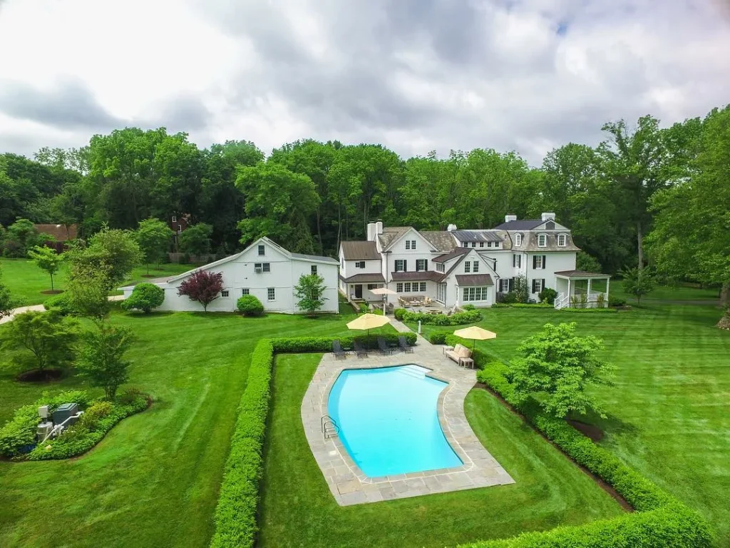
- Detail shots of features that matter to buyers, such as a pool, a large backyard, a solar array, or a corner lot
This mix is what separates property aerial photography that actually helps a listing from a single generic overhead snapshot. A single top-down photo tells a buyer almost nothing emotionally. A well-composed set tells a story about the property in a way ground photography alone cannot match.
Why Westminster’s Market Rewards Strong Aerial Visuals
Westminster sits in a genuinely competitive stretch of the Denver metro, wedged between Boulder and Denver proper, with easy access to Standley Lake, the Butterfly Pavilion area, and a mix of established neighborhoods and newer developments. That geography matters for marketing. Buyers moving to Westminster are often comparing it directly against Broomfield, Arvada, and Northglenn, and a lot of that comparison happens online before anyone books a showing.
A few things make aerial imagery particularly effective here:
- Lot size and green space are selling points. Many Westminster properties back up to open space, trails, or water features that a ground photo simply cannot capture. An aerial shot can show a buyer, at a glance, that a home backs up to Standley Lake Regional Park or sits close to a greenbelt trail.
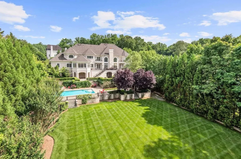
- New construction and larger lots benefit from scale. Newer subdivisions on the west side of Westminster often have larger lots and layout advantages that only read clearly from above.
- Commercial and multi-unit properties need context. Parking layout, access roads, loading areas, and proximity to US-36 or Federal Boulevard are far easier to communicate with an aerial shot than a paragraph of text.
Homes marketed with aerial photography tend to attract more online engagement than listings using ground-level photos alone, according to data long cited by MLS platforms and real estate marketing groups. That advantage compounds in a market like Westminster, where buyers are often weighing several nearby suburbs against each other and forming an impression in the first few images they see.
Our Real Estate Drone Photography Services in Westminster
Creative Drone Solutions structures its Westminster work around a few core service types, so clients can pick exactly what a listing needs rather than paying for a one-size-fits-all package.
Property Drone Photography for Residential Listings
This is our most requested service. We shoot single-family homes, townhomes, and condos with an FAA-compliant Part 107 licensed pilot, using stabilized 4K-capable drones that produce clean, sharp stills even in the wind conditions Colorado is known for. Every session is timed around golden hour or soft midday light whenever a client’s schedule allows, since lighting has more influence on how a home reads online than almost any other single factor.
A typical residential shoot includes a set of overhead and oblique images covering the front elevation, backyard, surrounding lot lines, and any standout features like a deck, pool, or mountain view. Files are delivered, edited and ready to upload directly to the MLS or a listing site.
Real Estate Aerial Photography for Larger Estates and Acreage
Properties on larger parcels, whether that is a horse property on the outskirts of Westminster or a home with significant acreage, are genuinely difficult to represent with ground photography alone. Aerial photography lets a buyer understand the full footprint of the land, fencing, outbuildings, and how the property sits relative to roads and neighbors. We often pair this with a short video flyover for listings above a certain price point, since buyers shopping in that range expect a more complete visual package.
Commercial Property Aerial Photography
Commercial clients have different priorities than residential sellers. A commercial property aerial photography session usually needs to communicate things like parking capacity, loading dock access, proximity to major roads, building footprint, and how a property relates to nearby retail or industrial neighbors. We shoot commercial listings, industrial parks, retail centers, and multi-family buildings around Westminster with that context in mind, framing shots that a commercial broker or investor can actually use in an offering memorandum, not just a marketing flyer.
What Separates Strong Property Aerial Photography From Mediocre Shots
Not all drone photography looks the same, and the difference usually comes down to a handful of technical and creative decisions made before the drone ever leaves the ground.
Flight planning matters more than gear. A more expensive drone will not fix a poorly planned flight path. We scout each property, at least virtually through satellite imagery and often in person, before a shoot, so we know exactly which angles will flatter the home and which will expose problems like an unflattering neighboring structure or a shadow line that falls wrong at a given time of day.
Light direction changes everything. Shooting a west-facing home at ten in the morning versus six in the evening produces two completely different results. We plan shoot times around the property’s orientation, not just around our own schedule, which is one of the small details that separates a professional result from a rushed one.
Editing has to stay honest. Buyers and their agents can tell when a photo has been oversaturated or when the sky has been swapped out for something unrealistic. Our editing process brightens, straightens, and corrects color without misrepresenting the property, which protects both the agent’s credibility and the seller’s legal exposure around advertising accuracy.
Composition should serve the listing description, not just look nice. If an agent’s listing highlights a large backyard, a mountain view, or proximity to a trail, the aerial shots need to visually back that claim up. We ask agents what they plan to emphasize in the listing copy before we shoot, so the images and the words work together instead of competing.
The Drone Photography Process: What to Expect When You Book
A lot of first-time clients are unsure what a booking actually involves, so here is the process we follow for most Westminster shoots.
- Initial contact and scope. A client reaches out with the property address, square footage or acreage, and what they are hoping to highlight. We confirm whether it is a residential, acreage, or commercial shoot and quote accordingly.
- Scheduling around light and weather. Colorado weather can shift quickly, especially with wind along the Front Range. We build in flexibility to reschedule around wind speed and cloud cover, since flying in poor conditions produces weak results no matter how skilled the pilot is.
- On-site shoot. Most residential sessions take between twenty and forty-five minutes on site. We check for FAA airspace restrictions in advance, since parts of the Denver metro fall near controlled airspace, and we always fly within Part 107 regulations.
- Editing and delivery. Images are color corrected, straightened, and prepared in the formats agents need for MLS upload, social media, and print flyers. Most clients receive their finished gallery within a few business days.
- Follow-up availability. If a listing needs updated shots later in the selling season, or if a commercial client needs seasonal refreshes, we make that easy to schedule again.
Why Hire a Professional Instead of Shooting DIY
Consumer drones have gotten cheap and easy to fly, and plenty of agents own one or know someone who does. That said, there are real reasons professional real estate drone photography consistently outperforms a DIY attempt.
- Licensing and legal compliance. Commercial drone use, including real estate marketing, legally requires an FAA Part 107 remote pilot certificate. Flying without one is a legitimate liability issue for an agent or brokerage, not just a technicality.
- Insurance coverage. Professional operators typically carry liability insurance that protects the client if something goes wrong during a shoot, which a hobbyist pilot usually does not have.
- Consistency across a portfolio. An agent listing multiple properties benefits from a consistent visual style across their brand, something that is hard to achieve shooting occasionally on a personal drone.
- Time saved. Between flight planning, actual flying, and editing, a quality shoot takes real time and skill to produce. Outsourcing lets an agent focus on the parts of the job only they can do.
- Better equipment and backup plans. Professional operators carry backup batteries, backup aircraft, and the experience to adjust a flight plan on the fly when wind or obstacles change the original plan.
None of this means a homeowner cannot take a decent casual shot with a personal drone. It means that when a listing’s marketing budget and timeline matter, professional real estate aerial photography is a small cost relative to the difference it makes in how a property is perceived.
How Aerial Photography Fits Into a Full Listing Marketing Plan
Drone photography works best as part of a broader visual strategy rather than a standalone add-on. Agents who pair aerial stills with ground-level interior photography, a short video walkthrough, and accurate floor plans tend to see the strongest overall engagement on their listings. Aerial images are particularly effective as the lead photo in an MLS gallery or as the hero image on a listing landing page, since they immediately establish scale and setting before a buyer scrolls into interior detail shots.
For commercial and multi-family properties, aerial photography also supports uses beyond the initial listing, including offering memorandums, investor presentations, zoning and permitting documentation, and ongoing construction progress tracking for properties still being developed.
Serving Westminster and the Surrounding Front Range
While this page focuses on real estate drone photography in Westminster, CO, Creative Drone Solutions also works throughout nearby communities including Broomfield, Boulder, and Louisville. That regional experience matters because Front Range weather, terrain, and airspace considerations are fairly consistent across the metro, and a pilot who understands local wind patterns and seasonal light angles produces more reliable results shoot after shoot, regardless of which suburb a property sits in.
Frequently Asked Questions
How much does real estate drone photography cost in Westminster, CO?
Pricing depends on property size and the number of shots needed, but most residential sessions fall within a standard photography add-on range. Commercial and acreage properties are quoted based on scope. Contact Creative Drone Solutions directly for a quote specific to your property.
Is drone photography legal for real estate in Colorado?
Yes, as long as the operator holds an FAA Part 107 remote pilot certificate for commercial use. Creative Drone Solutions flies fully licensed and insured, and checks local airspace restrictions before every Westminster shoot.
How long does a real estate drone photography session take?
Most residential shoots take between twenty and forty-five minutes on site, depending on property size and the number of angles requested. Commercial or acreage properties may take longer to cover fully.
Can drone photos be used directly on the MLS?
Yes. We deliver edited, MLS-ready files in the resolution and format agents need, so images can be uploaded directly without additional editing on the agent’s end.
What happens if it’s too windy or cloudy to fly?
We monitor weather closely and reschedule shoots when wind speed or visibility would compromise image quality. This protects the final result and is a standard part of professional drone operation in Colorado’s variable climate.
Do you offer both photography and video for the same listing?
Yes. Many Westminster clients pair real estate drone photography with a short aerial video flyover or cinematic aerial videography package for a more complete marketing set, especially for higher-value listings.