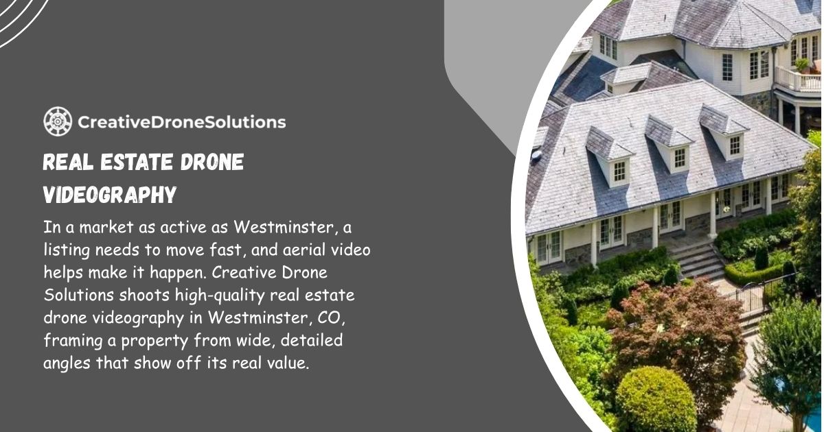
Selling a home or leasing a commercial property in Westminster takes more than a few phone photos and a sign in the yard. Buyers now scroll through listings the way they scroll through everything else, quickly, and the properties that stop the scroll are the ones with a real video, shot from the air, showing the whole picture. That is where real estate drone videography in Westminster homeowners and agents trust comes in. At Creative Drone Solutions, we film homes, land, and commercial buildings from angles a ladder or a tripod could never reach, and we turn that footage into a video that actually helps a property sell faster.
This page walks through what our drone videography service covers, how it differs from standard real estate photography, what commercial clients should know, and how the whole process works from the first phone call to the final delivered file.
Why Real Estate Drone Videography Matters in Westminster’s Housing Market
Westminster sits in a strange and useful spot. It has that classic Front Range mix of established neighborhoods, new construction pushing north near 144th, and a skyline view of the mountains that photos on the ground rarely capture well. A drone changes that. It can show a buyer the distance to Standley Lake, how close a property sits to the Little Dry Creek trail system, or how a backyard lines up against open space that a street level photo would completely miss.
Buyers relocating from out of state, and there are plenty of them moving into the Denver metro area, rely almost entirely on video before they ever schedule an in person tour. If the only visual they get is a handful of flat interior shots, they are far more likely to skip the listing altogether. A well shot aerial video answers questions before they are even asked: How big is the lot? What is the neighborhood like? Is there a busy road nearby? Drone footage answers all of that in under sixty seconds.
Westminster’s Growing Market and Buyer Expectations
Home prices and days on market shift constantly, but one thing has stayed consistent over the past few years: listings with video, especially aerial video, get more clicks and more saved favorites on platforms like Zillow and Redfin. Agents in Westminster who add drone footage to their marketing package are simply meeting where buyer behavior already is. It is not a luxury add on anymore, it is closer to a baseline expectation for anything priced above the entry level tier.
What Property Drone Videography Includes at Creative Drone Solutions
When people search for property drone videography in Westminster, they are usually picturing one wide aerial shot of a roofline. Our service goes well beyond that. A complete shoot typically includes a mix of aerial and ground level footage, edited together into one cohesive video that tells the story of the property from the street to the sky.
Here is what a standard residential package includes:
- Establishing aerial shots showing the full lot, roofline, and surrounding streets
- Smooth reveal shots that rise from ground level up over the home
- Orbit shots that circle the property to show all sides
- Close in flyover of backyard features like pools, patios, or landscaping
- Neighborhood context shots showing parks, trails, or nearby amenities
- Optional interior walkthrough footage paired with the aerial sequence
- Color graded, music synced final video delivered in formats ready for MLS, YouTube, and social media
Cinematic Aerial Walkthroughs
A cinematic walkthrough blends smooth drone movement with interior footage so the video feels like one continuous story rather than a slideshow of separate clips. This style works especially well for move up homes and new builds where the flow between rooms and the outdoor space is a major selling point.
Twilight and Golden Hour Drone Shoots
Some of the strongest performing real estate videos we produce are shot right around sunset. Twilight drone footage, with interior lights glowing and the sky turning shades of orange and purple behind the Rockies, tends to outperform daytime-only footage in engagement. It is a small addition to a shoot that makes a noticeable difference in how premium a listing feels.
Neighborhood and Lifestyle Context Shots
For buyers moving from out of town, seeing the property alone is not enough. We often include short clips of nearby parks, walking trails, or commercial areas so viewers understand the lifestyle that comes with the address, not just the square footage.
Real Estate Aerial Videography vs Traditional Photography: What’s the Difference
Agents sometimes ask why they should add video on top of the photos they already have. The honest answer is that photography and videography do two different jobs, and the strongest listings use both.
- Photography captures individual, polished moments, ideal for print flyers, brochures, and still image galleries on listing sites.
- Real estate aerial videography captures movement and scale, showing how spaces connect and how the property sits within its surroundings.
- Photos are static and require the viewer to imagine the transitions between rooms or areas of the lot.
- Video removes that guesswork by physically moving the viewer through the space.
- Aerial video is the only practical way to show total lot size, roof condition, or proximity to major roads and green space.
- Video content is shared and watched at a far higher rate on social platforms, which extends a listing’s reach beyond the MLS.
Neither one replaces the other. A listing with sharp interior photography and a well produced drone video simply performs better than one with just photos, and it costs far less than most agents expect once they see the return in showings booked.
Commercial Real Estate Drone Videography in Westminster
Residential listings get most of the attention, but commercial real estate drone videography in Westminster is where aerial footage often makes the biggest practical difference. Commercial buyers and tenants are evaluating things photos simply cannot show well: traffic flow, parking capacity, loading dock access, roofline condition, and how a property sits relative to major corridors like US-36 or Sheridan Boulevard.
Site Surveys and Progress Documentation
Developers and contractors use our drone footage for more than marketing. Regular aerial passes over a construction site create a visual timeline of progress that is useful for investor updates, insurance documentation, and internal project tracking. A single flyover, repeated monthly, can show grading, foundation work, framing, and final completion in a way written reports cannot match.
Retail, Office, and Industrial Property Marketing
For leasing agents, drone video helps a prospective tenant understand a property’s context immediately: how close it sits to anchor tenants, how visible the signage is from the road, and how much parking is actually available during peak hours. This matters even more for industrial and warehouse space, where truck access and yard size are often the deciding factor for a lease.
FAA Compliance and Safety: Why It Matters When Hiring a Drone Videographer
Anyone flying a drone commercially in the United States is required to hold an FAA Part 107 Remote Pilot Certificate. This is not a minor detail. Flying without it is illegal, and it usually means the operator has not been tested on airspace rules, weather limitations, or safety procedures.
Westminster sits within range of controlled airspace around Rocky Mountain Metropolitan Airport and the broader Denver airspace, which means certain areas require prior authorization before a drone can legally fly. A licensed operator knows how to check airspace restrictions, request authorization when needed, and fly in a way that keeps neighbors, property, and people on the ground safe.
At Creative Drone Solutions, every pilot on our team is FAA Part 107 certified, and we carry commercial liability insurance for every shoot. Clients are welcome to ask for documentation before booking. It is a fair question, and one that too many buyers forget to ask until something goes wrong.
How the Drone Video Process Works With Creative Drone Solutions
Most clients want to know exactly what happens between booking a shoot and receiving the final video. Here is our typical process from start to finish:
- Initial consultation where we discuss the property, the goal of the video, and any specific shots the client wants included.
- Scheduling around light and weather, since wind, rain, or overcast skies can change the plan on short notice.
- On site flight, usually completed within 30 to 60 minutes for residential properties and longer for larger commercial sites.
- Editing and color grading, where raw footage is trimmed, stabilized, and set to music or narration if requested.
- Client review, giving the agent or owner a chance to request adjustments before final delivery.
- Final delivery in formats ready for MLS uploads, YouTube, Instagram, and other marketing channels.
Most residential turnaround times run between 24 and 72 hours after the shoot, depending on the season and how many projects are in the queue. Commercial projects with larger footage libraries can take a bit longer.
Areas We Serve Near Westminster, CO
While Westminster is home base, we regularly shoot properties throughout the surrounding communities, including:
- Broomfield
- Arvada
- Thornton
- Northglenn
- Federal Heights
- Superior and Louisville
- Parts of northwest Denver
If a property sits somewhere between these areas, it is worth a quick call rather than assuming it is out of range.
Pricing and What Influences the Cost of Aerial Real Estate Video
Pricing for drone videography is rarely one flat number, and any company that quotes without asking a single question about the property is guessing. A few factors that actually move the price:
- Property size, since a five acre lot takes longer to cover than a standard suburban parcel
- Whether interior walkthrough footage is included alongside aerial shots
- Twilight or sunrise scheduling, which sometimes requires a second visit
- Turnaround time requested, with rush delivery typically costing more
- Commercial site complexity, including multiple buildings or restricted airspace paperwork
We provide a quote after a short conversation about the property rather than a generic package price, because a two bedroom townhome and a ten acre commercial lot are simply not the same job.
Tips for Realtors: Getting the Most Out of Your Drone Video
A few small decisions before the shoot day can noticeably improve the final result:
- Schedule the shoot before staging is removed, not after
- Mow the lawn and clear driveways the morning of the flight
- Ask for a twilight add on for higher end listings
- Share any specific angles you know buyers respond to in your market
- Use the final video across every platform, not just the MLS listing
Agents who treat the drone video as a core part of the marketing plan, not an afterthought, consistently see stronger engagement on their listings.
FAQ’s
How much does real estate drone videography cost in Westminster, CO?
Cost depends on property size, whether interior footage is included, and turnaround time. Most residential shoots are priced individually after a short call. Commercial and larger properties are quoted separately based on site complexity and flight time required.
Do I need a permit for drone videography near Westminster?
Individual property owners do not need a permit. The drone operator, however, must hold an FAA Part 107 certification and may need airspace authorization near Rocky Mountain Metropolitan Airport depending on the property’s location.
How long does a drone video shoot take?
Most residential shoots take 30 to 60 minutes on site. Commercial or larger properties can take longer depending on the number of buildings and angles needed. Final edited video is typically delivered within 24 to 72 hours.
Can drone video be used for commercial real estate listings?
Yes. Commercial real estate drone videography is especially useful for showing parking capacity, traffic access, loading areas, and a building’s position relative to major roads, details that ground level photos rarely capture well.
What happens if the weather is bad on the scheduled shoot day?
Shoots are rescheduled at no extra cost if wind, rain, or poor visibility make flying unsafe or would result in low quality footage. Safety and video quality always come before keeping a fixed date.
Is drone video better than regular real estate photography?
They serve different purposes. Photography captures polished still images for listings and print materials, while aerial video shows scale, flow, and surroundings that photos cannot fully communicate. Most strong marketing packages use both together.