Westminster is growing fast, and so is the number of people who need a view from above to prove it. Whether you’re listing a home near Standley Lake, tracking a build near the Denver-Boulder corridor, or promoting a business along 120th Avenue, ground-level photos only tell half the story. That’s where aerial photography services in Westminster come in. At Creative Drone Solutions, we fly, shoot, and edit professional drone imagery that helps local businesses, agents, and property owners show what a standard camera simply can’t capture.
This isn’t a hobbyist operation with a drone bought last weekend. Every flight we run is planned, licensed, and executed with the same seriousness you’d expect from any other professional photography service, just with a bird’s eye view added to the toolkit.
Why Westminster Businesses and Homeowners Are Turning to Drone Photography
Westminster sits in a unique spot. It has the open land and mountain backdrops of a suburban Colorado city, but it’s also close enough to Denver and Boulder to attract serious commercial development. That combination creates a lot of demand for aerial imagery, and for good reason.
Here’s what’s driving the shift toward drone photography in Westminster:
- Real estate listings with aerial shots get noticed faster and tend to sit on the market for less time, because buyers can see the lot size, the neighborhood layout, and the proximity to parks or trails before they ever schedule a showing.
- Contractors and developers need a documented, dated record of construction progress that protects them if a dispute ever comes up.
- Local businesses want marketing content that actually stands out on social media instead of blending into a feed full of phone photos.
- Property managers and roofing companies use drones to inspect areas that would otherwise require a ladder, scaffolding, or a risky climb.
None of this is new to the industry as a whole, but it’s still underused locally. A lot of Westminster businesses simply don’t know professional drone photography is this accessible, or this affordable, until they start asking around.
What Makes Professional Drone Photography Different from DIY Shots
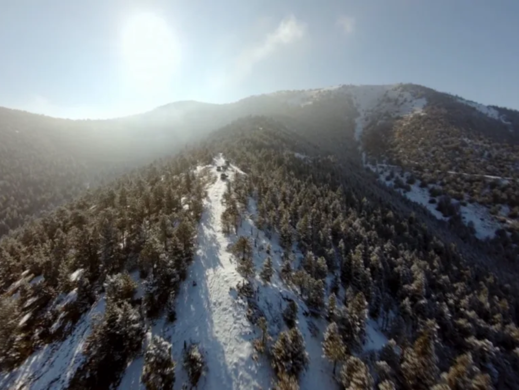
Almost anyone can buy a drone. Fewer people can fly one well enough to produce images that actually look professional. This is the part of the process that gets glossed over on a lot of competitor pages, so it’s worth explaining clearly.
A consumer drone in untrained hands tends to produce shots that are slightly crooked, poorly lit, or framed without any real composition strategy. It’s the difference between a snapshot and a photograph. Professional drone photography accounts for several things a hobbyist typically misses:
- Time of day and lighting. Golden hour changes everything about how a property or landscape reads in a photo. We plan flights around light, not just around availability.
- Camera settings and post-processing. RAW image capture, proper exposure bracketing, and color correction in editing software make the final image usable for marketing, not just for a quick social post.
- Composition and framing. Knowing how to use leading lines, rule of thirds, and elevation changes to make a property or site look its best.
- Airspace awareness. Westminster sits within range of several controlled airspace zones tied to nearby airports. Flying legally and safely here requires more than just common sense, it requires proper authorization through the FAA’s LAANC system when applicable.
That last point matters more than people realize. A drone operator who doesn’t understand local airspace restrictions isn’t just producing lower quality work, they could be putting your project, and their license, at risk.
Our Aerial Photography Services in Westminster, CO
Creative Drone Solutions was built around one idea: local businesses and homeowners deserve access to the same quality of aerial imagery that big-budget productions use, without the big-budget price tag. Here’s a breakdown of what we offer.
Real Estate Drone Photography
This is one of our most requested services, and for good reason. Aerial real estate photography gives potential buyers context that ground photos can’t. We capture full property overviews, lot boundaries, neighborhood context, and even twilight aerial shots that make a listing stand out in a crowded MLS feed. Packages typically include a mix of still images and a short flyover video edited for use on Zillow, Instagram, or a listing website.
Construction and Progress Monitoring
For builders and developers working around Westminster, we provide scheduled aerial documentation that tracks a project from groundbreaking to completion. This creates a visual paper trail that’s useful for client updates, investor reports, and, if needed, dispute resolution. Weekly, biweekly, or monthly flight schedules can be set up depending on the pace of the build.
Commercial and Marketing Photography
Storefronts, office parks, warehouses, and event venues all benefit from aerial branding content. A single well-composed drone shot of your business location can do more for a website homepage or a paid ad campaign than a dozen ground-level photos.
Event Coverage
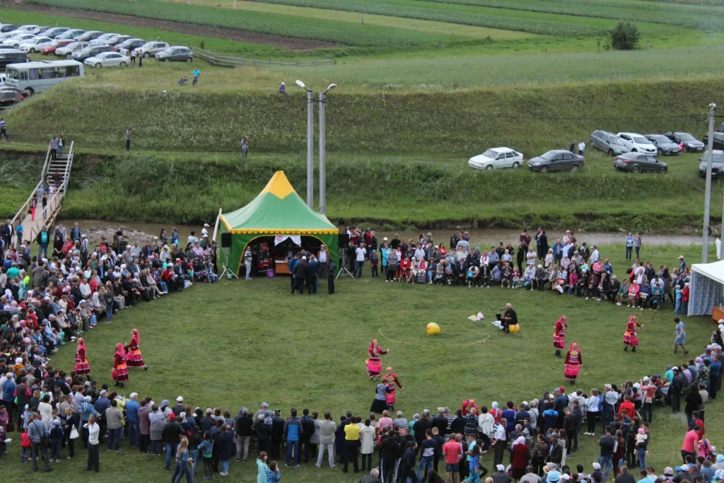
Weddings, festivals, sporting events, and grand openings often look completely different from above. We offer aerial coverage that complements traditional photography and videography, capturing crowd size, venue layout, and scale in a way that ground shots can’t replicate.
Roof and Property Inspections
Roofing companies, insurance adjusters, and property managers use our drone inspection service to get a clear, close-up view of roofs, gutters, and hard-to-reach structures without the liability of sending someone up a ladder.
Agricultural and Land Surveys
Westminster and the surrounding areas still have working agricultural land, and landowners use aerial imagery to monitor crop health, irrigation patterns, and overall land use over time.
[Internal Linking Idea: “Commercial Drone Photography for Colorado Businesses” service page]
The Creative Drone Solutions Process
A lot of what separates a good drone photography experience from a frustrating one comes down to process. Here’s how a typical project runs from start to finish.
Step one: consultation and site assessment. We talk through what you need, whether that’s a single property shoot or an ongoing construction monitoring contract, and we check the site’s airspace classification ahead of time.
Step two: flight planning. We map out flight paths, shot angles, and the best time window for lighting. For real estate, that often means scheduling around sunrise or sunset. For construction sites, it’s usually about matching prior flight angles so progress comparisons stay consistent.
Step three: the flight itself. On shoot day, our licensed pilot arrives with backup batteries, a pre-flight safety checklist, and the right equipment for the job. Weather is checked the morning of every flight, since wind and visibility directly affect image quality and safety.
Step four: editing and delivery. Raw footage and images go through color correction, stabilization if needed, and final selection. Most projects are delivered within a few business days, though rush turnaround is available for time-sensitive listings.
This kind of structured approach is what makes the difference between imagery that looks like it was thrown together and imagery that actually helps close a sale, win a client, or protect a project.
FAA Licensing, Safety, and Insurance
This section exists because it matters, not because it sounds good on a webpage. Anyone offering commercial drone services in the United States is legally required to hold an FAA Part 107 Remote Pilot Certificate. This isn’t optional, and it isn’t the same as the registration a hobbyist drone owner completes.
Creative Drone Solutions operates under full FAA Part 107 compliance. That means:
- Our pilot has passed the FAA’s aeronautical knowledge test covering airspace classification, weather, and flight regulations.
- Flights near controlled airspace, which applies to parts of Westminster given its proximity to Denver-area airports, are cleared through the proper authorization process before takeoff.
- We carry liability insurance specific to drone operations, which protects both the client and the property during a shoot.
- Pre-flight checklists are followed on every job, covering equipment inspection, weather conditions, and airspace status.
If a company can’t confirm they’re Part 107 certified, that’s a red flag worth taking seriously. It’s not just a legal issue, it’s a direct indicator of how seriously they take the work overall.
Industries We Serve in Westminster
Westminster’s economy is diverse enough that our client list looks pretty varied too. Some of the industries we regularly work with include:
- Residential and commercial real estate agencies
- General contractors and home builders
- Roofing and property inspection companies
- Local retail and restaurant businesses needing marketing content
- Event planners and venues
- Agricultural landowners in the surrounding county areas
- Insurance adjusters requiring documented property assessments
If your industry isn’t listed here, it doesn’t mean we can’t help. Most aerial photography needs come down to the same core skills: safe flying, strong composition, and reliable editing, applied to whatever the project calls for.
What to Expect: Pricing and Turnaround
Pricing in the drone photography industry varies more than people expect, mostly because the scope of work varies so much. A single-property real estate shoot is a very different job than a multi-month construction monitoring contract. That said, here’s a general idea of what affects cost:
- Scope of the shoot. A quick 20 to 30 minute session for a single property costs less than a full-day commercial shoot with multiple locations.
- Deliverables requested. Still images only will cost less than a package that includes video, editing, and a rush turnaround.
- Recurring versus one-time work. Ongoing construction documentation is often priced as a package rate rather than per-visit, which usually works out more affordable for the client over time.
- Location and airspace complexity. Sites requiring special airspace authorization may involve a small additional planning fee.
Turnaround for most standard shoots runs between two and five business days. Rush delivery is available for real estate listings that need to go live quickly.
We always recommend getting a direct quote rather than relying on a generic price list, since the right package really does depend on what you’re trying to accomplish.
Choosing the Right Drone Photography Company in Westminster
Not every drone operator is going to be a fit for every job, and it’s worth knowing what to look for before you hire one.
Ask about their FAA Part 107 certification directly. Ask to see a portfolio that reflects the type of work you need, since a company that’s great at wedding aerials might not be the right fit for a construction monitoring contract. Ask about insurance coverage, especially if the shoot involves flying over private property, a business in operation, or an active job site. And ask about turnaround time upfront, so there are no surprises when a listing deadline is approaching.
At Creative Drone Solutions, we’d rather answer these questions before you hire us than have you find out the hard way that a cheaper option skipped a few important steps.
Conclusion
Aerial photography has moved from a novelty to a genuine business tool in Westminster, and the businesses that adopt it early tend to stand out from the ones still relying on ground-level photos alone. Whether it’s a home that needs to sell faster, a construction project that needs a documented history, or a business that wants marketing content people actually stop scrolling for, professional drone photography delivers a perspective that’s hard to replicate any other way.
If you’re ready to see your property, project, or business from a new angle, Creative Drone Solutions is here to help, with the licensing, equipment, and local knowledge to get it done right the first time.
FAQ’s
Is drone photography legal in Westminster, CO?
Yes, as long as the operator holds an FAA Part 107 certification for commercial work. Some areas near controlled airspace require additional authorization before flying, which a licensed operator will handle as part of the planning process.
How much does aerial photography cost in Westminster?
Pricing depends on the scope of the shoot, deliverables, and location. A single real estate shoot typically costs less than a multi-location commercial project. Requesting a direct quote gives the most accurate estimate for your specific needs.
How long does it take to get drone photos after the shoot?
Most standard projects are delivered within two to five business days. Rush delivery is available for time-sensitive needs like real estate listings with an upcoming deadline.
Can drones be used for construction site monitoring?
Yes, drones are commonly used to document construction progress over time. Scheduled flights create a visual timeline that’s useful for client updates, investor reporting, and resolving any project disputes.
Do I need to be present during the drone photography shoot?
It’s not required, but it can help for larger commercial or real estate projects where specific shots or angles are a priority. For standard listings, providing a shot list beforehand usually covers everything needed.
What’s the difference between hiring a professional versus using a personal drone?
A licensed professional understands airspace rules, lighting, composition, and editing in ways that produce consistently usable, high-quality imagery. A personal drone can capture a photo, but it rarely matches the quality needed for marketing or documentation purposes.